Hurricane Melissa Category 5: The Truth Behind the Viral Satellite Image
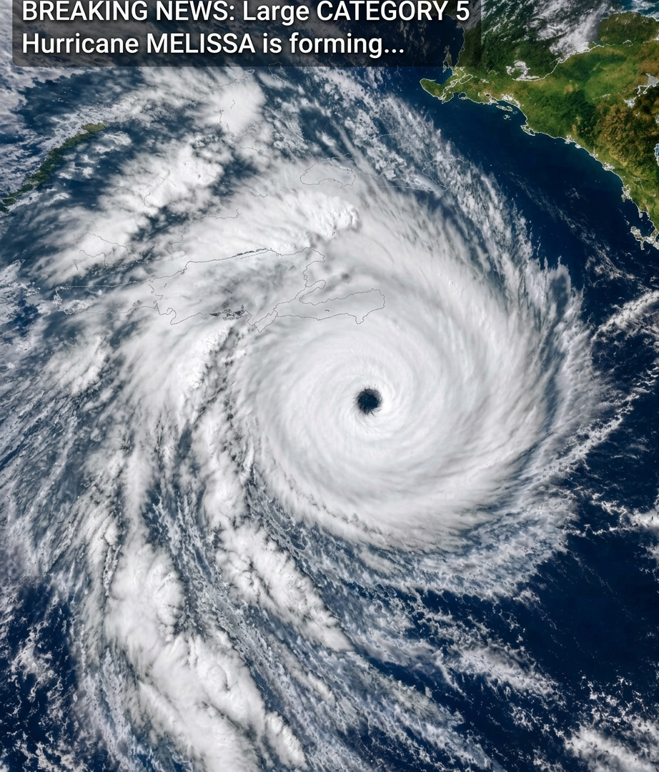
A dramatic satellite-style image showing a massive hurricane swirling over the Caribbean has been circulating online with the headline “BREAKING NEWS: Hurricane Melissa Category 5 forming.”
The image looks alarming, with intense purple, red, and orange colors surrounding a clearly defined eye. But before sharing the post, there is an important detail to understand: Hurricane Melissa was a real storm in October 2025, and the caption is misleading if it presents the storm as newly forming in October 2026.
What Was Hurricane Melissa?
Hurricane Melissa was one of the most powerful hurricanes ever recorded in the Atlantic basin. In October 2025, it intensified rapidly over exceptionally warm Caribbean waters and reached Category 5 strength.
On October 28, 2025, Melissa made landfall in southwestern Jamaica as a catastrophic Category 5 hurricane. The storm brought destructive winds, storm surge, and severe flooding, causing extensive damage across Jamaica and affecting other parts of the Caribbean.
The U.S. National Hurricane Center documented Melissa’s development, track, and intensity in its official advisories.
Why Was Melissa So Powerful?
Several environmental conditions contributed to Melissa’s extraordinary intensity.
Exceptionally warm ocean water
Hurricanes draw energy from warm ocean water. When the ocean is sufficiently warm, evaporation supplies moisture to the atmosphere, helping thunderstorms release heat and strengthen the storm’s circulation.
Favorable atmospheric conditions
Warm water alone does not guarantee a powerful hurricane. Atmospheric moisture, wind shear, and the structure of the storm also influence how quickly it intensifies.
Melissa encountered conditions that supported rapid intensification, allowing its winds to increase dramatically over a relatively short period.
Slow movement near Jamaica
Melissa’s movement also contributed to the danger. A slow-moving major hurricane can expose the same areas to destructive winds and prolonged heavy rainfall, increasing the risk of flooding and landslides.
What Do the Purple and Red Colors in the Image Mean?
The image uses enhanced colors to distinguish different features of the storm. Depending on the satellite product, colors can represent infrared brightness temperatures, cloud-top characteristics, or other atmospheric measurements.
The brightest colors do not automatically represent the strongest surface winds. Satellite images must be interpreted alongside meteorological observations and official storm analyses.
The photograph alone also cannot establish its precise capture time or prove that it is a live image.
Is Hurricane Melissa Forming Right Now?
No evidence in this viral post establishes that a new Hurricane Melissa is forming today. Official records confirm that Melissa was the name of the powerful 2025 Atlantic hurricane.
The storm’s name and historical imagery should not be confused with a current weather alert. Anyone concerned about an active hurricane should consult the latest updates from the relevant national meteorological service and the U.S. National Hurricane Center for Atlantic storms.
How to Recognize Misleading Hurricane Posts
During hurricane season, dramatic images and old forecasts can circulate again with new captions. Before sharing a weather warning:
Check the publication date and time.
Look for the storm on an official meteorological website.
Confirm that the location and forecast match the report.
Distinguish archived satellite imagery from current observations.
Follow local emergency instructions if a real warning is issued.
These steps can help prevent outdated information from causing unnecessary alarm.
Final Thoughts
Hurricane Melissa was a genuine and devastating Category 5 hurricane that struck Jamaica in October 2025. However, the viral caption does not establish that Melissa is forming again or that the image represents current conditions.
The storm’s history is important, and so is accurate reporting. When a post uses the words “breaking news,” checking the date and official weather records can make all the difference.
Have you seen this hurricane image shared as breaking news recently? Check the original posting date before sharing it with others, and rely on official weather services for current storm information.