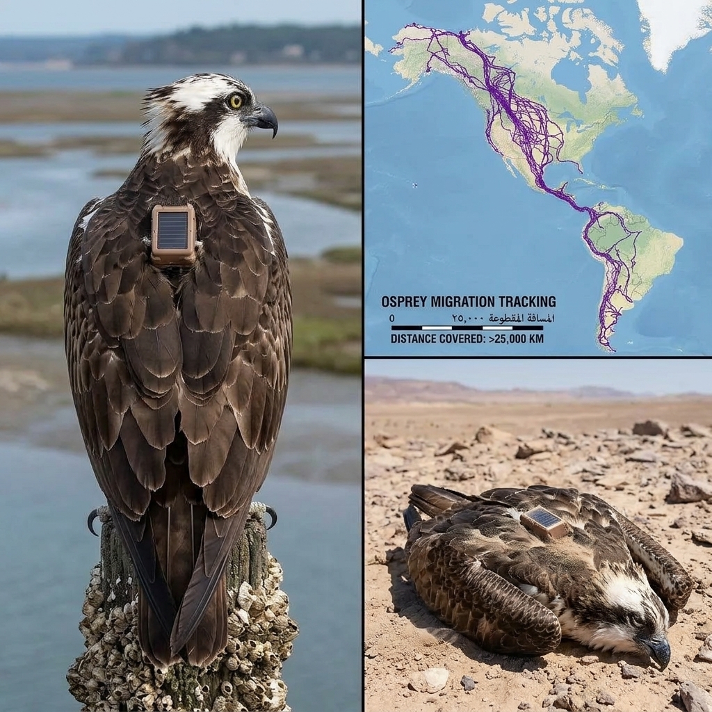
An Eagle Tracked by GPS for 20 Years? Debunking a Viral Bird Migration Myth
1. The Problem: Exaggerating and Distorting Real Wildlife Research
Sensational posts surrounding wildlife tracking rely on proven engagement strategies:
Truncated Headlines (Clickbait): Using broken prompts (“See below⤵️”) forces users to click through or scroll down to the comment section to finish reading the story.
Personifying a Single Animal: Presenting a map containing dozens of overlapping annual migration routes as the journey of a single heroic bird creates a gripping narrative, but it is scientifically inaccurate.
The “Astronomical Phone Bill” Legend: A popular spin-off myth claims Russian scientists went bankrupt because an eagle (named Minin) sent tracking SMS messages while roaming in Iran. While a real financial incident did occur in 2019 for the Russian Raptor Research and Conservation Network, it involved Steppe Eagles sending GSM data over a few months, not the eagle shown in this photo.
2. Explanation: What Does This Migration Map Actually Show?
From an ornithological and technological perspective, the map and photos highlight legitimate scientific research:
The Species Involved: The birds tracked in these projects are Imperial Eagles (Aquila heliaca) or Steppe Eagles (Aquila nipalensis), migratory raptors that spend summers breeding in Central Asia or Eastern Europe and winters in the Middle East, East Africa, or Southern Africa.
Avoiding Large Bodies of Water: The tracking map clearly shows how raptors avoid crossing the Mediterranean Sea or the Red Sea. Because heavy soaring birds rely on thermal updrafts—which do not form over open water—they travel along narrow terrestrial flyways (such as the Bosporus Strait or the Great Rift Valley).
Lifespan of GPS Transmitters: Modern solar-powered GPS/GSM tags weigh around $30\text{ g}$ and recharge via small solar panels. However, it is extremely rare for a single tag to transmit continuously for 20 years due to harness wear, electronic failure, or natural bird mortality.
3. Advice & Steps: How to Verify Viral Wildlife Maps
To avoid sharing distorted scientific stories about wildlife, follow these simple fact-checking steps:
1. Perform a Reverse Image Search
Upload the map or animal photograph to a reverse image search engine to trace it back to the original scientific study or ornithological research group (such as the Mevliya Foundation or Life Great Spotted Eagle).
2. Distinguish Single Tracks from Group Datasets
A map containing a dense web of crisscrossing lines spanning multiple continents almost always represents compiled dataset points from a whole cohort of tagged birds over several years, not a single individual’s flight path.
3. Check Recognized Conservation Sources
Refer to official bird conservation organizations (such as BirdLife International) which publish accurate satellite tracking maps and explain the real conservation challenges facing migratory raptors.
Disclaimer & Safety Guidelines
This article is provided for general educational, scientific literacy, and fact-checking purposes. Viral posts assigning legendary feats to a single animal often distort the painstaking tracking work conducted by field ornithologists. To support migratory raptor conservation, rely on verified information from recognized scientific institutions.